
Greenfield ZIP Directory Coverage
Four ZIP codes serve Greenfield, yet none draws a neat line around the city. Wisconsin's official ZIP classification and Milwaukee planning sources show shared delivery areas. The table records the broad official descriptions without turning them into hard neighborhood borders. Use it to choose a likely postal zone, then confirm the exact address through the USPS ZIP Code Lookup.
| ZIP | Area served | Accepted city labels | Greenfield search note |
|---|---|---|---|
| 53219 | Part of southwest Greenfield, Milwaukee, West Allis, and West Milwaukee | Milwaukee preferred; Greenfield alternate | Crosses several municipal lines, so verify the parcel |
| 53220 | Greenfield and Milwaukee portions | Milwaukee preferred; Greenfield alternate | Used by central and eastern Greenfield addresses |
| 53221 | Part of southeast Greenfield and Milwaukee | Milwaukee preferred; Greenfield alternate | ZIP does not settle the ward or city boundary |
| 53228 | Greenfield and Milwaukee portions, with New Berlin in reference material | Milwaukee preferred; Greenfield and New Berlin alternate | Used in western and southwestern Greenfield |
The shared pattern matters more than any informal neighborhood name. A 53228 result can describe mail in Greenfield, Milwaukee, or New Berlin. A 53219 result can cross four municipalities. None of the four is documented here as a Greenfield-only, PO-box-only, or institution-only code. Save the city label exactly as USPS returns it, while keeping the separately verified municipality in another field.
Why Greenfield Mail Says Milwaukee
USPS preferred-city names support mail delivery; they do not declare municipal residence. Wisconsin reference material lists Milwaukee as the preferred label for 53220, 53221, and 53228 while accepting Greenfield as an alternate. The city description for 53219 also places part of Greenfield inside a wider southwest delivery area.
Keep three facts apart: the postal city, the municipal city, and Milwaukee County. An assessor result can establish that a parcel is in Greenfield even when the mailing line says Milwaukee. A ZIP alone cannot select the right court, school district, polling ward, or tax office. Those boundaries come from their own custodians.
Search Greenfield Records by ZIP
No inspected Greenfield portal publishes a full people list filtered only by ZIP. Use a ZIP code directory as a routing tool. USPS verifies delivery geography, MyVote accepts a full address with ZIP, and the Greenfield property form accepts a house number and street rather than a ZIP. The deed index relies on names, parcel details, and legal descriptions.
- Enter the complete address in USPS. Save the ZIP and preferred city exactly as returned.
- Check the street address in the Greenfield property search. Save its tax key and address result.
- Use exact address mode in MyVote Wisconsin for current voter services. Do not treat it as a streetwide roster.
- Move to the relevant custodian only after municipality and county are clear. Preserve the lookup date because postal and civic data change.
Once the ZIP narrows the area, the Greenfield street directory gives the address-by-address parcel workflow. That shift is essential: a ZIP identifies a delivery zone, while the tax key and legal description identify a parcel.
Greenfield USPS Search Fields
The official USPS tool offers three different modes. Pick the mode that matches the question, then carry its postal answer into a records system. The tool warns that a delivery result does not verify a person or company at the address.
| Mode | Fields | Best use | Limit |
|---|---|---|---|
| By Address | Company optional, street, city, state, optional ZIP | Verify one delivery label | Does not identify a resident |
| By City and State | City, state | Test Greenfield and Milwaukee labels | Broad postal result |
| Cities by ZIP | ZIP | Document accepted locality names | Not a municipal boundary |
The Wisconsin ZIP classification provides another official check on preferred and alternate names. Use the live USPS address result for current delivery, and cite the dated reference when explaining why an older record uses another city label.
The official USPS search screen shows these address-oriented modes:
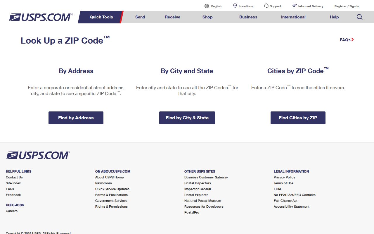
The screen is a postal verification aid, not a resident index. Copy its returned address format before moving into Greenfield municipal records.
Greenfield ZIP Portal Crosswalk
A ZIP appears in some local searches but not others. MyVote address mode asks for street, optional unit, city, and ZIP. The Greenfield assessor instead exposes Tax Key No, House No, and Street Name. Milwaukee County deeds search by party, instrument, tract, parcel, subdivision, lot, or block. WCCA filters by county, not ZIP.
This split explains why there is no single ZIP-wide residents roll. Start with a complete address, choose the system based on what it can prove, and label every name by source type. An assessed owner, a deed party, and a registered voter are distinct facts. No one result establishes who is inside a home today.
Note: Greenfield's assessor form has no ZIP field, so postal verification must happen before the address enters the property search.
Greenfield ZIPs Versus City Limits
A ZIP boundary follows delivery needs, while Greenfield's border follows municipal history. The city grew from a much larger township as land shifted into West Allis, West Milwaukee, Greendale, Hales Corners, and Milwaukee. Those changes can place an old record under a different place name without changing the county deed trail.
- ZIP and ZIP+4
- A ZIP marks a delivery area. Four added digits narrow mail to a smaller delivery segment.
- PO-box ZIP
- A code used chiefly for boxes at a postal facility. No such Greenfield-only code was established in the research.
- Unique ZIP
- A code assigned to one high-volume organization. The four Greenfield codes are shared area codes, not documented unique codes.
- Carrier route
- A postal delivery path within a ZIP. It is not a parcel line or city boundary.
The City of Milwaukee's older ZIP planning map and its ArcGIS ZIP layer add visual context. Neither should replace current USPS verification or Greenfield parcel evidence. No official date-stamped ZIP split history was located, so do not infer a boundary change by comparing an old map to today's lookup.
Record Greenfield ZIP Evidence
Keep the original postal label beside the current verified label. This is especially useful for directories, newspapers, deeds, and family files created at different times. A clean research row should contain the printed address, normalized street, postal city, municipal city, ZIP, ward or district when relevant, county, tax key, legal description, source date, and lookup date.
Do not overwrite an older ZIP with today's code. A route can change without a deed, parcel, or resident change. Likewise, an address in a neighboring ZIP may appear in a Greenfield obituary or directory because it was a mailing address, relative's address, or former residence. Preserve what the source says, then add the verification as a separate note.
Note: A ZIP result narrows geography, but only the source custodian can confirm the legal or civic boundary relevant to a record.
When Greenfield ZIP Searches Fail
A blank result can reflect formatting, not absence. Retry the full street with and without its directional prefix, unit, or suffix. Test both Greenfield and Milwaukee as the city while keeping Wisconsin and the known street fixed. Then use the assessor's house-and-street fields, because its lack of a ZIP box avoids postal-city mismatch.
If the address still fails, call the Greenfield Assessor at 414-329-5340 or inspect the assessment roll at City Hall. For map context, use the Greenfield public GIS link or ask the Milwaukee County Land Information Office about county layers. A focused records request under Wisconsin Public Records Law, Wis. Stat. §§19.31–19.39, should identify the address, date range, record type, and desired format.
Historical work may also require the Milwaukee Public Library directory and map collections. Old place names and former township boundaries can be more useful than a modern ZIP code directory when a record predates today's postal geography.